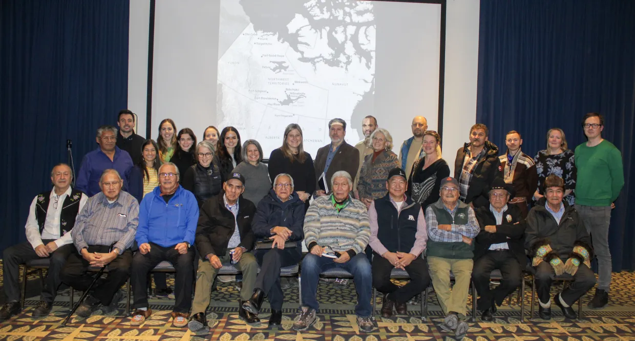
This report was prepared by Justin Barnes, Tessa Varvares, and Jennifer Spence for Permafrost Pathways based on insight from the Community Voices on Permafrost Thaw workshop held on December 8–9, 2025 in Yellowknife, Northwest Territories. Chief Bill Erasmus, International Chair of the Arctic Athabaskan Council, provided the foreword.
Foreword
It is important to understand the legal Aboriginal and Treaty rights that exist in the Northwest Territories of Canada.
Many of us remember the Federal Government buildings the “Arthur Lang” office high-rise and the “Fraser Tower.” They were built in 1967 to accommodate the new civil servants flown up from Ottawa and to establish the Government of the Northwest Territories (GNWT). The first resident Commissioner, Stewart Hodgson, was appointed to oversee the transfer of the territorial government from Ottawa to Yellowknife. He was Commissioner from 1967 to 1979 and established the elected system that is in place today.
The Dene have always maintained that the GNWT is “not their government” and very few people participated in its operation. However, in 1979, at a meeting in Drum Lake, it was decided that it was important to participate in GNWT elections and be employed by them if people so chose. The goal was to elect Dene People into office and fight for Dene Government in the communities. The Dene, including the Inuit and Métis People, outnumbered the non-native people and always had a majority of members in office. However, the senior bureaucracy (which is primarily non-native and from the south) always controlled the outcomes.
In 1972, the Dene Chiefs of the Mackenzie Valley challenged the Federal Government on their version of Treaty #8 - 1899-1900 and Treaty #11 - 1921-1922. Canada had informed the Dene that they surrendered all their rights (including Dene title) to the British Crown on behalf of Canada. The Federal Government’s official position was that Aboriginal Peoples in Canada did NOT have any rights that were different from “other” people in the country. In regard to “Indians,” Prime Minister Pierre Trudeau said, “you may have had Aboriginal rights but they were extinguished by Treaties or Canadian legislation.”
In 1973, Justice William Morrow of the Supreme Court of the Northwest Territories ruled in what is commonly called “the Paulette Case” (after Chief François Paulette, the youngest Chief in the court case):
that they… “are present day DESCENDANTS of those DISTINCT INDIAN groups who, ORGANIZED IN SOCIETIES AND USING THE LAND as their forefathers had done for centuries, have Since Time IMMEMORIAL used the land… as theirs.”
“that those same Indigenous people… are PRIMA FACIE OWNERS of the lands… that they have what is known as Aboriginal rights.”
“… that there exists a clear CONSTITUTIONAL OBLIGATION on the part of the Canadian Government to PROTECT THE LEGAL RIGHTS of the Indigenous peoples in the area…”
“That notwithstanding the language of the two Treaties THERE IS SUFFICIENT DOUBT ON THE FACTS THAT ABORIGINAL TITLE WAS EXTINGUISHED…”
“That the above purported claim for ABORIGINAL RIGHTS CONSTITUTES AN INTEREST IN LAND…”
This ruling was never appealed on the question of title or rights; therefore, it is the law in the Northwest Territories and Canada.
Shortly after this decision, the Nishg’a (Indians) in the Nass Valley in Northwestern British Columbia, led by Frank Calder (from a non-Treaty area), also won at the Supreme Court of Canada, establishing that their Aboriginal rights still exist.
Canada was forced to recognize Treaty and Aboriginal rights because of court action. Rather than implement the court case’s outcomes, the Canadian government established a “land claims policy” which fell short of recognition of “outright ownership of their lands and resources” and invited the Dene, Inuit, and Métis Peoples of the North, including the Nishg’a, to negotiate an agreement with them.
Consequently, amongst the Dene communities, only 7 out of 32 communities have concluded self-government arrangements. In the communities that have not concluded agreements, the GNWT functions as their government (and receives funding on their behalf) and continues to impose on the Dene and the north.
In this report, you will read about the frustration experienced by people living in these conditions, especially when emergency management is at play in the Arctic. The Canadian government, and especially the GNWT, has ignored the Paulette case and has buried it from sight. Winning a lawsuit in Canada doesn’t necessarily mean it will be implemented, especially if you are “Aboriginal” as defined in the Constitution Act, 1982.
Chief Bill Erasmus Arctic Athabaskan Council International Chair
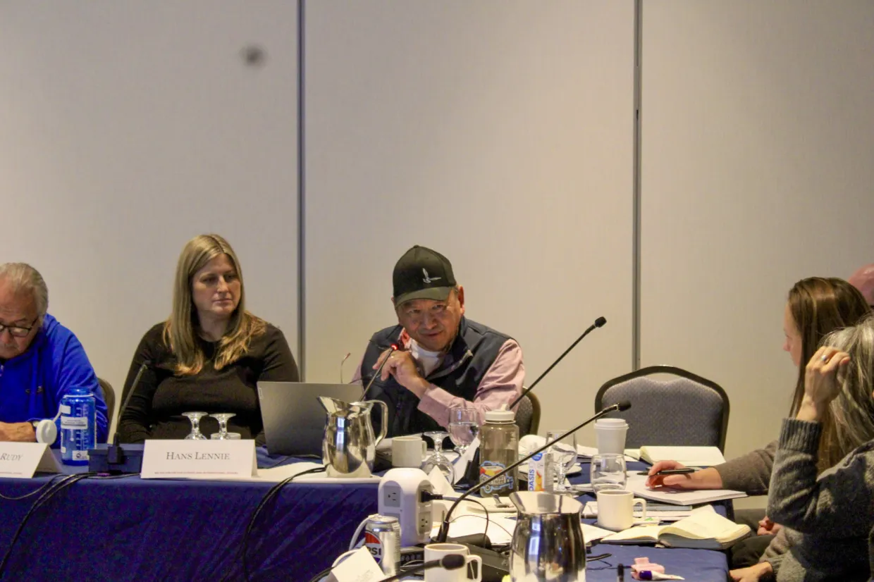
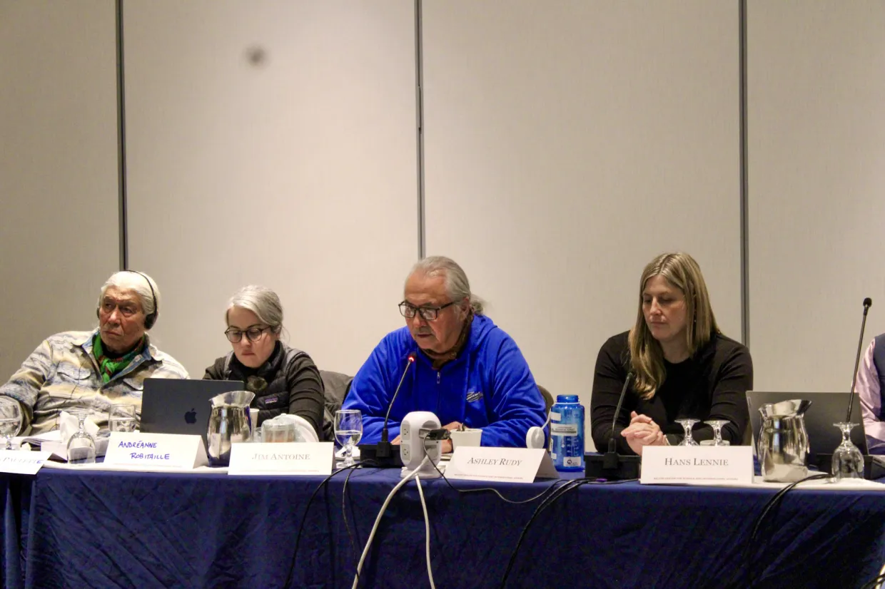
Hans Lennie, Assistant Manager of Lands – IRC Inuvialuit Land Administration
Pat Martel – Katlodeeche First Nation
François Paulette – Fort Fitzgerald
Collin Pierrot – Fort Good Hope
Joe Rabesca – Behchokǫ̀
Jonas Sangris – Dettah
Panelists and Guest Experts
Ágúst Bogason, Senior Research Advisor – Nordregio
Mark Cronk, Director – Government of Northwest Territories Design & Technical Services, Department of Infrastructure
Devlin Fernandes, Executive Director – Gwich'in Council International
Greg Fiske, Senior Geospatial Analyst – Woodwell Climate Research Center
Per Henning, Advisor in the Saami Council – Arctic and Environmental Unit
Kumari Karunaratne, Director – Northwest Territories Geological Survey
Chris Paci, Vice President of Research – Aurora College
Michelle Pond, Head of Emergency Management Organization Municipal and Community Affairs – Government of Northwest Territories
Brendan Rogers, Senior Scientist – Woodwell Climate Research Center
Ashley Rudy, Permafrost Geohazard Scientist – Government of Northwest Territories
Sarah Sargent, (Virtual) Vice President, Canadian Operations Programming - Canadian Red Cross
Robyn Starycki, Geotechnical Engineer - Government of Northwest Territories
Facilitators
Jennifer Spence, Director – Arctic Initiative, Harvard Kennedy School
Chief Bill Erasmus, International Chair – Arctic Athabaskan Council
Tessa Varvares, Program Manager – Arctic Initiative, Harvard Kennedy School
Liane Benoit, Senior Advisor – Arctic Athabaskan Council
Anika Affleck, Senior Public Health Project Officer – Government of Northwest Territories
Justin Barnes, Predoctoral Research Fellow – Arctic Initiative, Harvard Kennedy School
Definitions of Key Terms
Indigenous
In this report, “Indigenous” refers to peoples or communities who self-identify and are recognized as having historical continuity with societies that existed before colonization, settlement, or the formation of modern states.1 The term also refers to peoples who maintain distinct cultural, political, legal, spiritual, kinship, land-based relationships and worldviews.
A related but distinct term is “Aboriginal,” which has a specific constitutional meaning in Canada. Section 35 of the Constitution Act, 1982 recognizes and affirms existing Aboriginal and treaty rights, and defines the Aboriginal peoples of Canada as First Nations, Inuit, and Métis peoples. While “Aboriginal” is closely tied to Canadian law and state recognition, “Indigenous” is more commonly used in contemporary academic, international, and political contexts to refer to sovereignty, land-based responsibilities, collective rights, and resistance to colonial erasure.2 This use is reflected in the United Nations Declaration on the Rights of Indigenous Peoples, a 2007 international human rights instrument that sets out individual and collective rights related to self-determination, culture, land, language, identity, and freedom from discrimination and forced assimilation.3
“Indigenous Peoples” is an international, legal, and political term shaped by colonial histories, and while it does not have one fixed global definition, it is used in this report to recognize that multiple Indigenous groups were represented during the workshop.4
Resilience
In this report, “resilience” refers to the notion of community resilience: a community’s collective ability to understand and reduce risk, draw on relationships and local or Indigenous Knowledge, communicate effectively, prepare for disruption, and use available resources and leadership to withstand, respond to, and recover from disasters or other forms of adversity.5 The term is context-dependent, especially for communities affected by colonialism, inequality, displacement, or structural violence.6 In this report, resilience is used to emphasize collective strength and self-determination, while recognizing that responsibility for the impacts of systemic barriers should not be shifted onto communities facing related systemic harms.
Introduction
Climate change is affecting northern Peoples through diverse impacts, including, but not limited to, land, water, infrastructure, food systems, health, and culture. Permafrost thaw, flooding, erosion, and wildfires are reshaping the landscape and disrupting daily life. Additionally, colonial legacies and experiences have shaped responses to these issues through their impact on leadership, authority, governance structures, families, and lifestyles in the North, as with other places in Canada. Participants expressed a great sense of urgency around these issues and changes.
The physical changes being experienced are altering water quality and quantity, raising contamination risks, shifting wildlife patterns, and threatening communities’ long-standing relationships with the land. Roads, buildings, drainage systems, and riverbanks are becoming less stable as frozen ground thaws, while falling water levels, disappearing lakes and wetlands, and changing fish and wildlife conditions are disrupting travel routes, harvesting areas, and food security. These physical changes carry major social, economic, and cultural consequences, placing strain on household budgets, community infrastructure, mental health, and the intergenerational transmission of land-based knowledge and practice.
These physical impacts, however, are not the only challenge. So too is the mismatch between those realities and the systems meant to address them. The Community Voices on Permafrost Thaw workshop was held on December 8–9, 2025 in Yellowknife, Northwest Territories to address these interconnected problems. The two-day workshop brought together representatives from 13 Indigenous communities who were joined by Government of Northwest Territories (GNWT) officials, climate scientists, and emergency management practitioners from across the Northwest Territories and the broader circumpolar Arctic. The workshop had three goals:
Move from shared knowledge to concrete plans and actions.
Identify shared challenges communities are facing with permafrost thaw and climate-related risks.
Co-develop solutions and actionable strategies.
This report summarizes the key perspectives, priorities, and actions shared by workshop participants on climate change, emergency management, and community resilience in their northern homeland. Workshop participants shared their experiences related to how:
Current governance structures have sidelined Indigenous and community-level authority during times of crisis.
Existing community strengths are often undervalued or unsupported by formal systems.
Funding systems are fragmented, short-term, or require additional capacity to access.
Emergency frameworks remain oriented toward sudden events rather than the slow, cumulative hazards that many communities face most often.
Indigenous Knowledge, local observation, community monitoring, cultural practice, and land-based leadership are essential foundations for effective action.
These goals and findings build on the outcomes of an earlier, primarily researcher-focused workshop in Whitehorse, Yukon, in 2024: Call to Action on Permafrost: Applying Knowledge and Research to Complex Problems Facing Communities. That workshop identified the challenges that knowledge-exchange processes must address for research to be genuinely useful for communities, while the 2025 Community Voices workshop identified what communities need in order to act on that knowledge in the context of urgent, immediate, and long-term crises. This report is grounded in that combined context and is a call for climate adaptation and emergency management approaches that are more community-led, culturally grounded, and responsive to the lived realities of northern Indigenous communities.
The report is organized into three main sections. The first examines community realities and interconnected hazards, highlighting the wide-ranging and compounding impacts of anthropogenic (human-caused) climate change across northern communities. The second explores the cross-cutting themes that emerged throughout the workshop that shape all aspects of emergency management. The third sets out priorities and recommendations for action across preparedness, prevention, response, and recovery processes.
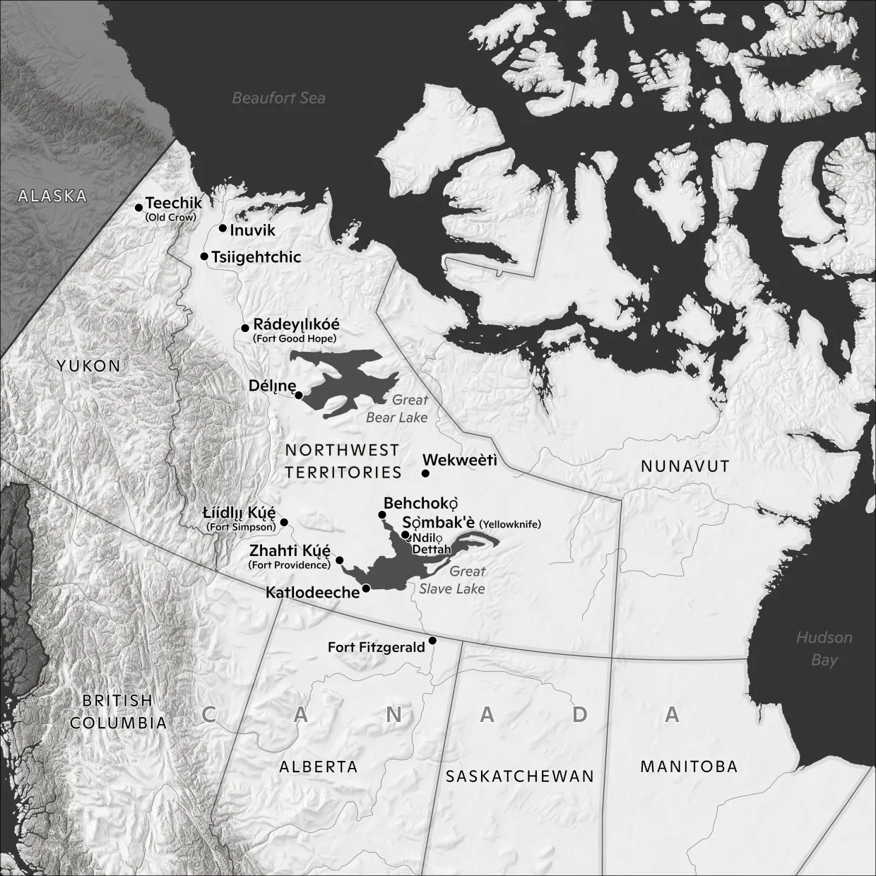
Greg Fiske
Home communities of the participants from the Community Voices on Permafrost Thaw workshop held in Yellowknife, Canada, in November 2025.
1. Community Realities and Interconnected Risks and Hazards
Participants stressed that community hazards cannot be understood in isolation. Permafrost thaw, flooding, wildfire, water scarcity, and ecological change were described as interconnected pressures that are intensifying with climate change and creating compounding risks for land, water, infrastructure, health, culture, and food systems. These impacts are environmental, economic, and social, placing a growing strain on both community budgets and individual households.
1.1. Permafrost Thaw and Land Change
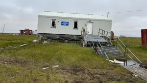
Permafrost thaw is visibly reshaping the built environment, making infrastructure harder to maintain and forcing changes in construction and relocation decisions.
Community representatives spoke of roads sinking, drainage systems failing, ground cracking, slopes collapsing, and buildings shifting as frozen ground loses stability. In places such as Tsiigehtchic and Inuvik, permafrost thaw has made infrastructure increasingly difficult and expensive to maintain: pilings rot, heave, and rise with repeated freeze-thaw cycles, buildings require regular re-levelling, and repair costs place heavy pressure on already limited community budgets. Construction methods that once worked reliably are becoming less effective as ground conditions change, forcing communities to continually adapt while facing rising costs for gravel, culverts, and other basic stabilization measures. Participants also described growing pressure to relocate specific infrastructure in some communities, including homes and cemeteries threatened by unstable riverbanks and landslide risk.
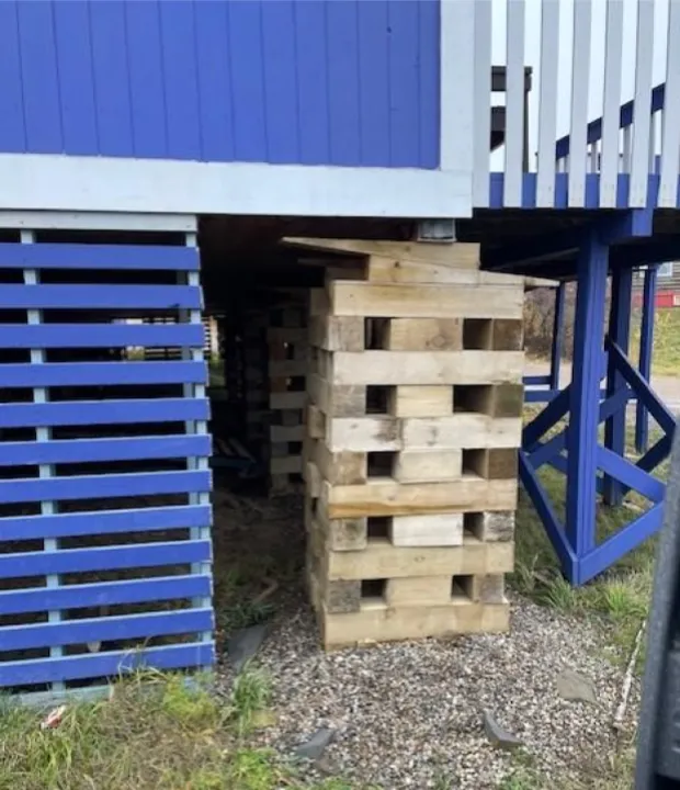
“No more wood is used [for pilings] because of rot from the thawing and freezing… because of heaving [the pilings] get pushed up from the bottom… All communities are switching to blocking now, but every 2-3 years you have to go re-level [the building] to compensate for continuous dropping. Even big buildings are falling apart because of all the shifting.” – Hans Lennie, Inuvialuit Settlement Region
Philip Blake
Pilings stabilizing a building in Tsiigehtchic built on thawing permafrost.
Communities are observing widespread landscape and hydrological changes that affect water levels, ecosystems, and access to land and resources.
As frozen ground thaws, water that was once held near the surface drains away, contributing to falling lake and river levels, drying wetlands, new sandbars, and reduced access to travel routes and harvesting areas. Elders’ and harvesters’ observations linked these changes to drying forests, leaning trees, eroding riverbanks, and the growing exposure of culturally important sites such as cemeteries, churches, and homes built near unstable slopes.
“I asked the Elder why [the water went down 2 ft on Great Bear Lake]. The Elder said it's because the permafrost melted — the lake maintains its levels because of the runoff. Instead of going into the lake now, it's going underground.” – Danny Gaudet
“Permafrost – you see drunken trees. Spruce trees where I live are starting to lean over. The roots don't have the water, they're drying up and they fall over." – Jim Antoine
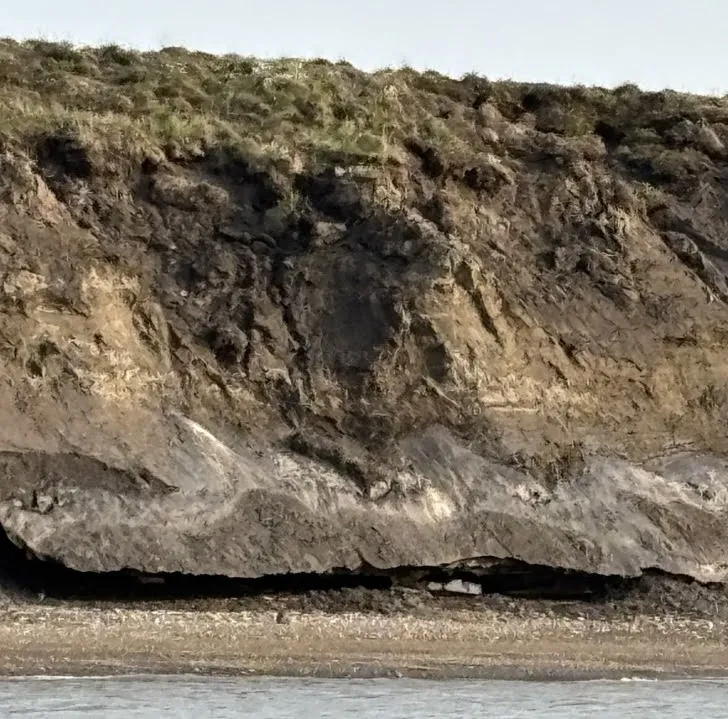
Hans Lennie
Thawing permafrost causes a bluff to slump and erode in Inuvik.
Changing ground conditions are creating new risks from legacy industrial sites, increasing long-term costs and safety concerns for communities.
In some regions, participants also pointed to a less visible but serious risk: legacy industrial sites and containment systems that were built on the assumption of permanently frozen ground are becoming less secure as thaw progresses. Overall, permafrost thaw was described as a long-term, interconnected process affecting land, water, transportation, cultural sites, and community safety.
“Historic oil and gas drilling sumps were buried and contained in permafrost — all this happened in the 50s and 60s. Inuvialuit have been worried about this for decades.” – Hans Lennie
Tessa Varvares
Hans Lennie describing the environmental impacts affecting the community members in Inuvik.
1.2. Water Changes: Health Impacts, Dropping Levels, and Culture
Changes in water are among the most immediate and far‑reaching consequences of permafrost thaw and climate change, reshaping northern hydrology and everyday life.
Across the region, lower water levels, shifting drainage patterns, and changing water quality are affecting travel, harvesting, ecosystems, and daily activities. Rivers, lakes, and wetlands that communities rely on for transportation, fishing, and cultural practices are becoming less predictable as warming temperatures, thawing ground, and changing seasonal patterns reshape northern hydrology. Participants spoke about rivers becoming harder to navigate, boat launches becoming unusable, and new sandbars and shallow channels disrupting routes that had once been reliable. In places such as the Buffalo and Hay River areas, drying waterways and wetlands are affecting travel, fish habitat, wildlife movement, and access to harvesting areas. Participants also described lakes shrinking or disappearing as thawing permafrost creates new drainage pathways, while other wetlands are gradually filling in through sedimentation and vegetation growth.
"I remember we used to paddle through the forest… Because of climate change, the weather wasn't cold enough to freeze [permafrost]… and now the water just soaks into the ground, and the lake no longer forms. I was disappointed for my son." — Roy Fabian
“In Fort Simpson, the water is really low and the land is drying up... The river near us is really low as well, and a huge sandbar has come up that's never been there before. It's new and now we need to find somewhere else to launch our boats.” – Jim Antoine
Tessa Varvares
Jim Antoine described how permafrost thaw has altered water levels in Fort Simpson.
Changing water levels and quality are creating serious challenges for drinking water safety, public health, and contamination management.
Participants described declining water tables, warmer conditions, organic materials, and other contaminants as contributing to boil water advisories and growing uncertainty about water safety. In Inuvik, participants raised concerns about high rates of H. pylori infection and other gastrointestinal illnesses that may be linked to contaminated water. In Délı̨nę, community members also described ongoing health concerns and emphasized the need for stronger local capacity to test water and identify contaminants more quickly. Participants also connected these concerns to broader contamination risks, including legacy waste sites, dump locations near water, industrial tailings, and older containment systems becoming less secure as permafrost thaws.
Water changes have implications for cultural and spiritual life as well as practices and relationships to land and food.
Participants spoke of water not just as a resource, but as central to identity, memory, and survival. Participants recalled a time when people could drink directly from lakes, travel waterways with ease, and rely on fish and wildlife in places that are now warmer, shallower, or less predictable.
“We are losing lots of water now, we have got to do something about water going down… That's the biggest issue for climate change.” – Charlie Football
“The water is going down. I know from listening to Elders, we have a lake with a big hole in the bottom with another lake underneath. When the lake gets too hot, the fish go down and way under there... Now, the water is so shallow, where do those fish go?” – Danny Gaudet
1.3. Wildfire and Drier Conditions
Hotter, drier conditions are transforming landscapes across the Northwest Territories and driving more frequent, more intense wildfires.
Participants described summers as longer and more intense than in the past, with spring now feeling like mid-summer in terms of heat and dryness. They linked these changes to lower snowpack, earlier drying, and increasingly fire-prone landscapes. Wildfire was framed as both a direct threat and a major ecological disruption, with fires now burning through areas once seen as natural buffers, such as lake- and wetland-rich regions, and burning more intensely, producing prolonged smoke exposure and smouldering deep into dry soils and peat as thawing permafrost and drought alter ground conditions.
“June 5 was [as dry as] July 31 in Fort Good Hope. So when people made a campfire, it took off on them ... within 45 minutes, this fire was at a full-blown forest fire that was out of control.” – Collin Pierrot
Participants expressed concern about wildfire management systems that allow fires to burn unless they threaten homes or critical infrastructure.
They noted that this approach can allow fires to burn for long periods and grow unpredictably, already affecting wildlife, harvesting activities, air quality, and community well-being. Several speakers connected wildfire to food security, describing how fires damage caribou habitat, alter migration routes, and reduce access to key harvesting areas. When harvesting is disrupted or made unsafe, households are pushed toward more expensive store-bought food, raising the cost of living and deepening existing inequities.
“The government only fights fire if it's a community threat or a cabin is nearby. And other than that, they let the fire burn. And when they do that in our area, the caribou ... migrate to other areas [like Alaska] where there is food... so we no longer have caribou in the winter. It creates hardship, and it drives up the cost for the harvesters, because they have to buy food from the store.” – Philip Blake
“There was a fire that was burning [underground] in 2022 and the government's policy is that unless a fire is a threat to infrastructure … they don't put out the fire. So that fire was smouldering all summer, just waiting for the right conditions for it to take off. And that's exactly what happened.” – Roy Fabian
Communities are demonstrating strong leadership and readiness, underscoring the need to center local capacity and Indigenous fire stewardship.
In Fort Good Hope, for example, community leaders and the Guardians program obtained funding and fire training ahead of the 2024 season, enabling local crews to play a critical role when fire threatened the community. Participants described Elders sheltering at a fish camp, local responders building fire guards, and community members deploying their own skills and equipment to protect homes and infrastructure when outside support was delayed or insufficient. These experiences underscored calls for fire management systems that better reflect northern conditions, recognize and fund community fire capacity, and support Indigenous approaches to fire stewardship, including cultural burning and other land-based practices.
2. Cross-Cutting Themes
Tessa Varvares
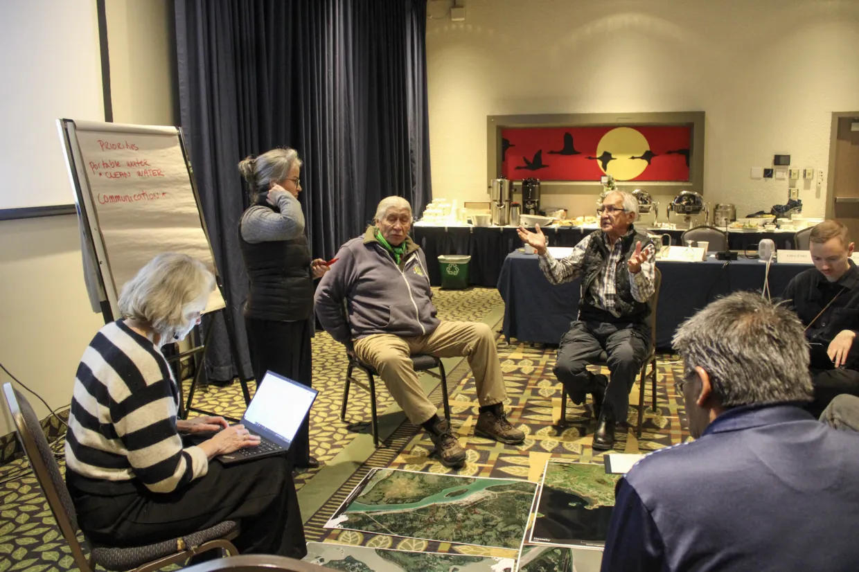
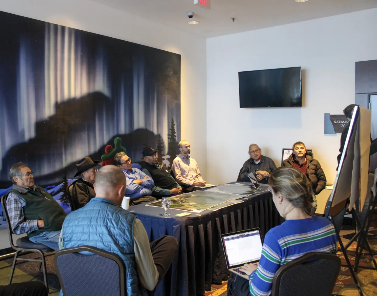
Participants discussed community priorities in small groups.
2.1. Cultural continuity and intergenerational knowledge are essential foundations of resilience.
Participants described cultural continuity as rooted in ceremony, land-based practices, intergenerational responsibility, and protocols guiding relationships with Dene lands and communities. François Paulette emphasized that fire should be understood not only as a hazard but also as a spiritual being, noting that his First Nation’s land use plan acknowledges the spiritual significance of fire, water, animals, and trees, and includes ceremonies honoring the role of fire. Participants stressed that cultural continuity depends on transmitting teachings to younger generations through experience on the land, not only formal schooling. Joachim Bonnetrouge observed that schools alone cannot carry this work and argued that teachings must be experiential, while Roy Fabian highlighted the importance of sharing with children cultural beliefs, knowledge, skills, spirituality, and activities that meet their holistic needs and support a future in their communities.
The discussion also highlighted expectations for visitors, researchers, and governments as part of upholding cultural continuity. Participants called for stronger, clearly established protocols for entering territory, engaging with communities, and conducting land-based work respectfully, including cross-cultural training and explicit guidelines for researchers, government staff, and other visitors to Dene territory.
Underlying these reflections was a strong sense of urgency, shaped by the erosion of Indigenous Knowledges through colonial institutions, the social disruption of COVID, and concern for what grandchildren will inherit, alongside recognition of renewal already underway through cultural camps, ceremonies, community teachings, and youth learning.
“Our First Nation has a land use plan and that also includes what you guys call wildfires. A fire is a spiritual being. It's a spirit, and so is water, and so are the buffalo, and so are the eagles, and so are the trees. If you're going to put a plan together, you need to recognize this, the spiritual recognition of the fire.” – François Paulette
Tessa Varvares
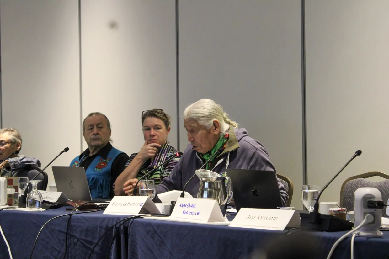
François Paulette emphasized the spiritual connection that Dene communities have with fire, land, and water.
Indigenous Knowledge is central to understanding climate impacts and guiding community preparedness, prevention, response, and recovery.
Participants emphasized that communities are the experts on their own lands, and that local observations help scientists, engineers, and governments understand what is happening on the ground while supporting better planning, documentation, and access to resources. Indigenous Knowledge should guide decision-making more directly, rather than being treated as secondary to outside expertise. Participants also highlighted the importance of building community capacity so younger generations can remain connected to their lands, contribute their skills at home, and continue strengthening preparedness and resilience.
“In my mind, the knowledge is in our communities, it's with our Elders – they (the government) aren't coming to us unless there's something really drastic. Our knowledge has to be brought to the forefront in those processes.” – Danny Gaudet
Roy Fabian
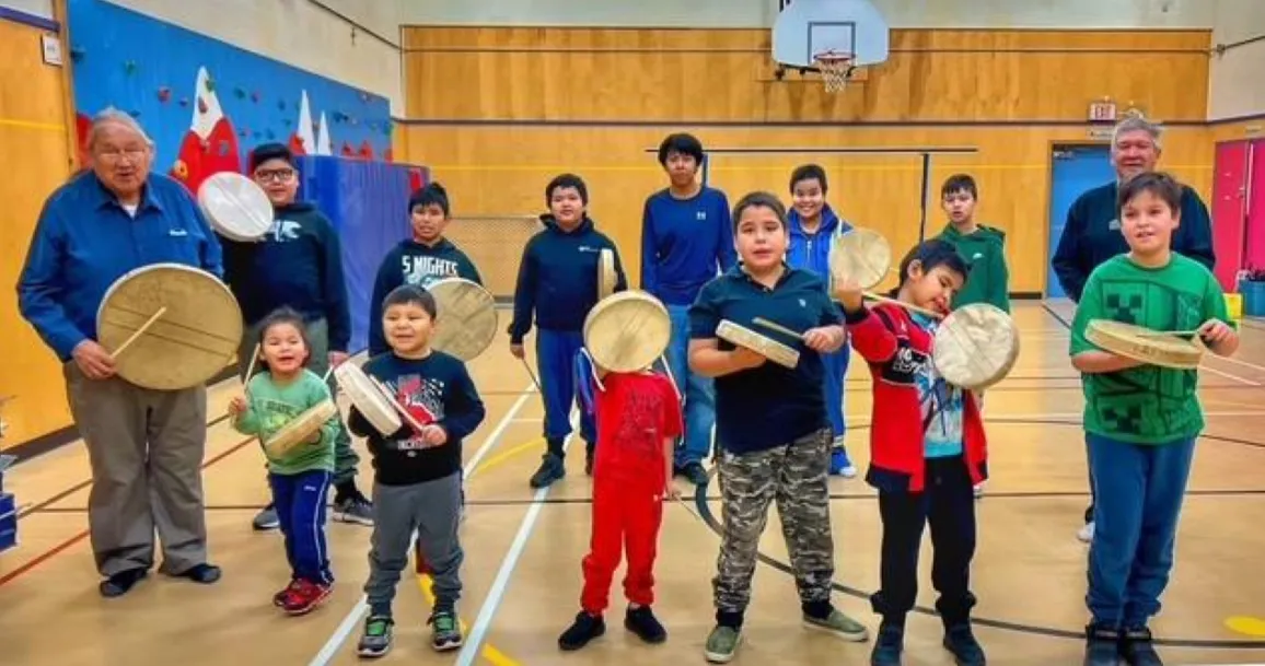
Cultural program activities with youth at Chief Sunrise School.
Trauma, health, and climate impacts are deeply interconnected.
Climate change was discussed not only as an environmental or infrastructure issue, but as a cause of repeated evacuation, food insecurity, cultural disruption, and mounting stress for individuals, families, and communities. Speakers described the emotional toll of these challenges and growing concern about the effect they will have on children and grandchildren.
The workshop also showed how emergency experiences can intensify existing trauma when communities feel excluded, abandoned, or unsupported, as in accounts from Fort Good Hope. Roy Fabian emphasized that recovery after floods and fires is often a bigger gap than the initial emergency response. Participants stressed that emergency management and climate adaptation must also support mental health, family wellbeing, cultural healing, and community-led recovery.
Effective crisis response depends on clear authority and strong local decision-making, with First Nation and community leaders recognized as primary decision-makers.
Across the workshop, participants expressed deep concern about who holds responsibility during emergencies, pointing to confusion between territorial, municipal, and First Nation leadership, as well as frustration when outsiders make decisions for local people. Excessive red tape, poor communication, and leadership structures that do not reflect lived experience were seen as factors that delay or weaken an effective response.
Participants emphasized that moving from research to action will require a shift in power, including better recognition of rights and greater community authority in policy and decision-making. Some called for clearer legislation to recognize the role of chiefs, while also noting that communities may need to use council decisions or develop their own laws in the meantime. More broadly, they called for respect for self-determination, including greater local control over leadership, governance, and data, with data sovereignty highlighted as a key aspect of community authority.
“The government had no fire equipment in our community. They had one water truck and one fire truck, and we used that to fight the fire. They tried to bring in more equipment, but we weren't allowed to use it because the government said we were a liability… When this fire took place, we were there to assist the government in fighting the fire, but they took it and turned it around into a fight about control." – Colin Pierrot
“It's about control — Fort Good Hope only survived because they were able to throw the shackles of the GNWT off and save themselves.” – Jim Antoine
Funding systems are slow, fragmented, and can drain community capacity instead of supporting timely action on climate and emergency risks.
Identifying relevant funding across multiple governments and departments was itself a barrier, especially when support is needed quickly before, during, and after crises. Participants also pointed to the mismatch between short-term funding and long-term climate challenges, as well as the strain of needing dedicated grant-writing capacity just to access available resources – an ongoing barrier that many communities continue to face. There was particular emphasis on the need for more coordinated, timely, and accessible funding resources so communities can focus on action rather than navigating complex systems.
Tessa Varvares
Workshop participants discussed priority recovery actions after communities are disrupted by extreme weather or environmental events.
3. Priorities for Action: Prevention, Preparedness, Response, Recovery
The following recommendations are intended to acknowledge and build on existing GNWT emergency management systems, programs, and commitments. They recognize the existence of the NWT Emergency Plan, the GNWT Emergency Response Plan, MACA’s emergency coordination system, Incident Command System (ICS) protocols, the GNWT Emergency Management Act, MACA’s territorial Emergency Management Framework, Community Emergency Plans, the Hazard Identification and Risk Assessment process, Community Wildland Fire Protection Plans, flood preparedness tools, disaster assistance programs, and relevant climate, infrastructure, and land-use planning initiatives.7 However, community representatives emphasized that, despite these existing plans, tools, and commitments, further action is needed to ensure they are consistently implemented, adequately resourced, and experienced effectively at the community level.
Recognizing that this workshop represents community-level experiences of these programs, the recommendations below largely focus on strengthening or adapting current approaches by clarifying local authority, supporting inclusion of Indigenous Knowledge and local expertise, expanding community-based monitoring, and ensuring more complete and culturally relevant mechanisms are developed and/or implemented. An overview of emergency management frameworks and procedures, as well as community case studies, were provided to participants to stimulate discussions on experiences related to prevention, preparedness, and response. Recovery emerged as a fourth dimension of emergency management that participants stated required more attention. These documents have been included in the Appendix.
3.1. Prevention
Participants framed prevention as proactive action to reduce risk before crisis, but also as a broader effort to protect a way of life. Prevention was discussed not only in relation to infrastructure and hazard reduction, but also in terms of protecting water, land, permafrost, food systems, cultural continuity, and community health. Across the workshop, participants emphasized that prevention is strongest when communities are in control of their information, combine Indigenous Knowledge with community-led science, and use local observations to guide decisions. They also stressed that prevention cannot be separated from land-based knowledge, cultural fire practices, youth learning, and healing.
Key Themes:
Community control over information and decisions: Participants called for greater local control over monitoring, hazard information, research, and data so communities can decide what is safe and what action is needed.
Community-based monitoring and early warning: Ongoing observation of erosion, ground instability, water levels, fish and wildlife health, and other environmental changes was seen as essential for identifying risks early. Guardian programs, GIS, drones, and local observation networks were identified as practical tools.
Proactive infrastructure and land-use planning: Prevention includes using hazard and permafrost mapping in planning, maintaining drainage systems, strengthening vulnerable infrastructure, and relocating assets from unstable areas where needed.
Indigenous stewardship and cultural continuity: Participants emphasized that prevention is inseparable from land-based knowledge, cultural teaching, and stewardship practices, including cultural burning, youth learning, and land-use planning grounded in community values.
Funding and policy gaps: Participants noted that prevention is weakened when funding is short-term, hazard information is not shared clearly, and support often arrives only after disasters occur.
Table 1. Prevention recommendations drawn from workshop findings.
Key Issues
Policymaker Recommendations
Researcher Recommendations
Community Recommendations
Funding Agency Recommendations
Service Provider Recommendations
Risk assessment and hazard mapping for flooding, erosion, landslides, and permafrost thaw threatening homes, cultural sites, and infrastructure.
Support the regular collection of updated hazard information and integrate it into local plans, land-use decisions, capital planning, and housing placement.
Fund mitigation or relocation pathways where identified by communities.
Work with communities and GNWT to develop community-scale hazard maps for erosion, thaw, slope failure, and flood change that can be used in planning decisions, where needed.
Produce practical planning guidance communities can use when reviewing land use and infrastructure options.
Identify and validate locally important sites at risk, including cultural and harvesting areas. Update regularly.
Fund long-term community-based monitoring and mapping programs. Cover training, equipment, and ensure community data ownership.
Work with communities to translate hazard data into practical tools (maps, storymaps, seasonal risk guides) for planning and communication.
Communities need stronger pre-season flood prevention.
Expand funding for breakup monitoring, flood watch protocols, and community flood protection planning in high-risk areas.
Advance localized breakup and flood-risk modelling with community input and monitoring data.
Organize and/or support local flood watchers. Identify priority protection zones and infrastructure issues.
Support multi-year mitigation funding (e.g., drainage improvements, shoreline stabilization, culverts).
Provide technical modelling support, seasonal forecasting, and practical mitigation guidance.
Communities want more wildfire management authority near settlements and on valued lands.
Use Community Wildland Fire Protection Plans more actively: fund fuel reduction, FireSmart work, local crew readiness, earlier responses, and a clear path for cultural or prescribed fire where communities want it.
Support communities in defining and communicating community values at risk, including cabins, trails, burial grounds, harvesting zones, and wildlife habitat.
Identify priority protection areas and support prevention work around the community.
Provide sustained mitigation funding (for reducing fuel around the community, firebreaks, etc.), not only suppression funding.
Fund community-based equipment.
Deliver FireSmart training, equipment support, and ongoing technical guidance.
Permafrost thaw is damaging roads, buildings, drainage, and travel routes.
Link permafrost hazard mapping and infrastructure standards directly to MACA/GNWT capital planning and community mitigation programs.
Prioritize regular maintenance to drainage, culverts, and site stabilization.
Generate practical engineering and monitoring guidance for permafrost thaw-sensitive roads, buildings, shorelines, and drainage systems.
Track recurring damage sites and document where early mitigation could reduce costs.
Fund climate-resilient infrastructure upgrades, drainage, and relocation where needed.
Support early action to reduce long-term costs.
Provide engineering advice and provide support for technical design of community infrastructure.
Water change, contamination experiences, and low water affect safety and access.
Treat drinking water security and low-water impacts as prevention priorities in emergency and adaptation planning.
Support community-based water monitoring and reporting.
Build community-led water monitoring programs with clear interpretations of findings.
Identify priority water concerns, unsafe areas, and communicate changes to access and travel routes.
Fund water infrastructure upgrades, monitoring programs, and local data ownership systems.
Provide water testing, technical advice, and emergency water supply support.
3.2. Preparedness
Effective preparedness was seen to depend on clear local authority, practical household readiness, stronger monitoring and communications capacity, and the transfer of land-based knowledge across generations. Participants also emphasized that preparedness frameworks must address not only acute events such as wildfire and flooding, but also slow-onset hazards such as permafrost thaw, low water, erosion, and infrastructure decline, which steadily undermine community safety and well-being.
Key Themes:
Community-led planning and clear authority: Participants stressed that preparedness is strongest when communities can lead and when roles are clearly defined among chiefs, councils, mayors, and other levels of government before an emergency occurs.
Preparedness at the household and community level: In remote communities, preparedness also means ensuring that families have the supplies, equipment, and support needed to manage until outside assistance arrives. This includes having reliable alert systems in place to promptly inform community members when an emergency is occurring and whether evacuation is necessary. Participants also noted the importance of psychological and social preparedness in communities already carrying stress from COVID, wildfire, flooding, and colonial trauma.
Monitoring, data, and local capacity: Participants identified community-based monitoring, GIS, drones, weather and ground-temperature monitoring, and locally controlled mapping as practical tools for preparedness, especially when combined with Indigenous Knowledge and Guardian programs.
Intergenerational preparedness: Preparedness was linked to youth involvement, land-based camps, and the passing on of cultural teachings, survival skills, and environmental knowledge.
Gaps in current systems: Participants pointed to low awareness of emergency plans within communities, weak planning for vulnerable people and hard-to-reach places, and funding systems that are too short-term and unstable to support long-term preparedness.
Table 2. Preparedness recommendations drawn from workshop findings.
Key Issues
Policymaker Recommendations
Researcher Recommendations
Community Recommendations
Funding Agency Recommendations
Service Provider Recommendations
Community emergency plans may exist on paper but are not always practical, current, or well understood.
Require and support regular updates of community emergency plans, support joint planning with Indigenous governments, and make room for local decision-making in territorial protocols.
Turn hazard data into plain-language and policy-relevant planning tools: local maps, seasonal readiness briefing notes, evacuation route maps, and infrastructure risk summaries.
Test usability of tools with communities.
Review plans yearly and request MACA-offered tabletop exercises.
Identify what works locally and what does not.
Confirm local priorities, contacts, and vulnerable households.
Provide multi-year funding tied to implementation of planning processes.
Allow flexible use of funds for staffing and exercises in communities.
Strengthen or expand funding for emergency plan updates, awareness, translation, staff, and annual exercises through existing MACA support streams for exercises.
Provide facilitation, training, and tabletop exercises.
Co-develop planning tools that reflect local hazards, governance arrangements, and return results in usable formats.
Need for clear lines of authority for territorial, municipality, Chief and Council, and Indigenous governments.
Work with community and partners to ensure lines of authority are practiced and understood.
Analyze past emergency responses to identify where authority breakdowns occurred and recommend clearer operational approaches.
Confirm in writing who leads locally and how leadership works together before the next event. Immediate steps could include developing a Memorandum of Understanding (MOU) between the local Chief and Mayor.
Fund joint planning forums, workshops, and tabletop exercises.
Provide mediation, facilitation, and governance training to align agencies before emergencies occur.
Evacuation readiness is uneven, especially for Elders, people without vehicles, and households with medical needs.
Expand funding and capacity support for developing pre-registration, assistance-needs lists, transportation plans, and host-community arrangements in high-risk communities.
Evaluate barriers to evacuation readiness and produce recommendations for practical improvements for northern and small-community contexts.
Maintain local lists of residents needing support.
Identify family and community hosting options where appropriate.
Fund dedicated evacuation readiness programs, including confirming local coordination roles.
Deliver preparedness workshops, distribute emergency kits, and provide targeted support to vulnerable populations (Elders, disabled, isolated households).
Communities want earlier public alerting systems and faster, clearer communication.
Standardize roles for providing public updates before breakup and fire season.
Develop and practice locally relevant communications protocols in emergency plans.
Co-design early warning and risk communication tools and processes with communities so warnings match local realities, timelines, and language.
Support local watchers and trusted messengers.
Share observations as early as possible.
Provide capital and operational funding for community-based alert systems and monitoring programs.
Provide technical support for locally-based monitoring systems and alert platforms.
Small communities often lack staff capacity for preparedness work.
Create dedicated preparedness coordinator roles for small and remote communities.
Link MACA workshops and tabletop exercises to funded local positions.
Evaluate what training, equipment, and staffing models work best in small northern communities and support community-led training design.
Identify and train local responders, coordinators, and alternates.
Run regular exercises and identify gaps before the season starts.
Create multi-year funding for local emergency coordinators and deputies.
Deliver certified training (ICS, first aid, wildfire support, evacuation coordination).
3.3. Response
Participants described a sharp disconnect between formal emergency response systems and what communities experience on the ground during crises. While emergency response plans generally exist, many participants said communities still feel largely on their own when wildfire, flooding, or other disasters occur. The strongest examples of effective response were community-organized, drawing on local leadership, land-based programs, trained local responders, and practical knowledge of people, places, and conditions. Participants emphasized that response systems work best when they recognize community authority, value local expertise, and are designed for the realities of remote and northern communities rather than assumed southern models.
Key Themes:
Communities have organized responses themselves: Participants described local leadership, mutual aid from other communities, fish camps, Guardian networks, and community-trained responders as critical assets when formal systems were delayed or ineffective.
Local knowledge is operationally essential: Community members’ knowledge of terrain, weather, vulnerable households, and culturally appropriate practices was seen as a response asset that outside responders often fail to recognize.
Authority and coordination remain unclear: Confusion over roles, delayed or unclear evacuation orders, and poor coordination between agencies were described as major barriers to effective response.
Remote community realities are not well reflected in current systems: Participants noted that centralized equipment, seasonal assumptions, and road-based response models do not match the conditions facing many remote and/or fly-in communities.
Evacuation and shelter require cultural and psychosocial supports: Response was discussed not only in terms of logistics, but also in terms of safety, dignity, trauma, and the need for culturally appropriate shelter, food, and support during displacement.
Community fire capacity is effective: Fort Good Hope’s fire training initiative was highlighted as a strong example of proactive local response capacity that was used during the 2024 fire season.
Table 3. Response recommendations drawn from workshop findings.
Key Issue
Policymaker Recommendations
Researcher Recommendations
Community Recommendations
Funding Agency Recommendations
Service Provider Recommendations
Communities reported delayed action and uncertainty about when outside help would arrive.
Clarify escalation thresholds and resource request procedures in every community plan, including information on how requests will be approved and actioned.
Ensure local leadership knows exactly when and how to request regional or territorial support.
Review previous incident timelines to identify where escalation was delayed or unclear.
Develop decision-support triggers for early action in northern contexts.
Review and practice escalation procedures during exercises.
Fund joint training exercises across agencies.
Develop and test mechanisms to ensure clear communication with communities on response timelines and expectations.
Local expertise was not always recognized or used effectively.
Create and support access to pre-season credentialing of community experts, insurance, and tasking pathways so local responders, Guardians, fire-experienced residents, and land users can be used safely and formally during incidents.
Document how local knowledge improved outcomes and propose models for operational integration.
Maintain lists of skilled people who can support firefighting, water monitoring, transport, communications, and on-the-land safety.
Fund local responder training, honoraria, insurance, and equipment to enable safe and official participation.
Integrate local residents with relevant experience into formal response structures.
Respect local leadership and expertise during emergencies.
Evacuations can feel chaotic and culturally disruptive.
Make host-community planning, transportation, registration, family reunification, and supports for Elders and vulnerable residents operational priorities.
Evaluate evacuation experiences with attention to timing, communication, cultural safety, trauma, and accessibility.
Keep local evacuation support lists updated and identify who needs help leaving.
Fund evacuation readiness and coordination, including transportation contracts and host community capacity.
Provide shelter management, registration, reunification, and culturally appropriate psychosocial supports.
Social support is often improvised during evacuations.
Require integration of mental health, cultural, and family supports into emergency response planning and delivery.
Study mental health and social impacts of evacuation and displacement.
Identify best practices for support.
Identify trusted local support people and community-specific needs before emergency events.
Fund mental health services, cultural supports, and family reunification programs as core elements of response.
Deliver psychosocial support, trauma-informed care, and culturally safe services during and after evacuation.
People need fast, trusted, locally relevant information.
Establish and/or resource local communications officers or designated spokespersons in emergency plans.
Use plain-language updates and local channels consistently.
Co-develop and test community-led communication protocols that integrate local knowledge, trusted messengers, and GNWT alerts.
Identify the most effective channels in each community (radio, Facebook, etc.) and suggest clear, practical recommendations.
Use trusted local channels and help correct misinformation quickly.
Fund entities conducting the collection and aggregation of critical data.
Provide public information support and culturally appropriate outreach.
Equipment shortages early on in a crisis can worsen outcomes.
Establish standards for minimum cache of equipment by hazard type for remote communities and regions.
Ensure equipment is maintained and usable locally.
Identify equipment and training gaps through post-event analysis and preparedness studies.
Maintain local inventories and confirm who can operate available equipment.
Fund equipment procurement, maintenance, and training programs for local responders.
Provide technical training, equipment support, and surge capacity during emergencies.
3.4. Recovery
Recovery was not a formal stream of the workshop agenda, but it emerged consistently throughout the workshop as an important consideration for many communities. Participants made clear that while recovery processes are necessary after fires, floods, and other climate-related disruptions, it is often happening without a framework that matches northern Indigenous realities. The discussion also showed that recovery cannot be understood only as rebuilding infrastructure: it includes healing from cumulative trauma, restoring cultural and land-based connections, supporting livelihoods and food systems, and addressing the longer-term impacts of ecological change. In this context, participants stressed that the period after an emergency is often where some of the deepest gaps appear.
Key Themes:
Recovery must formally be a fourth domain of emergency management: Participants described how some communities have been moving from one disruption to the next without fully stabilizing in between. Recovery was discussed as a long-term condition shaped by repeated fire, flood, evacuation, low water, erosion, and other compounding pressures.
Trauma, healing, and cultural recovery are central: Recovery was closely tied to mental health, addiction, colonial trauma, and the strain of repeated disruption. Participants also pointed to land-based camps, ceremonies, and community cultural practices as important recovery resources within communities that could be better supported.
Current systems are reactive and need to be more context-specific: Participants described recovery support as short-term, policy-constrained, and shaped by southern assumptions. Roy Fabian’s comments on the 2022 flood in K’atl’odeeche First Nation underscored this gap: the community was left out of key recovery processes, and housing needs remained unresolved as winter approached.
Ecological recovery and climate-informed rebuilding are major gaps: Recovery was discussed not only in terms of homes and infrastructure, but also in terms of damaged harvesting areas, changed landscapes, and uncertainty about what recovery on the land will look like over time. Participants emphasized that rebuilding cannot simply reproduce previous vulnerabilities.
Recovery needs stronger governance and learning processes: Participants pointed to the need for a more coherent federal-territorial-Indigenous approach to post-disaster recovery, as well as community-led after-action reviews that can drive changes in legislation, funding design, and adaptation policy.
Table 4. Recovery recommendations drawn from workshop findings.
Key Issues
Policymaker Recommendations
Researcher Recommendations
Community Recommendations
Funding Agency Recommendations
Service Provider Recommendations
Disaster recovery funding is often slow, hard to access, and focused too narrowly on physical damage.
Simplify application processes.
Enable rapid, upfront funding access.
Expand eligibility from primarily infrastructure to include social, cultural, and land-based recovery.
Evaluate where current disaster assistance does not match remote, Indigenous, or harvesting-based realities.
Track recovery barriers and delays, and document unmet needs (housing, land, cultural impacts).
Provide flexible funding, reduce reporting burden, and allow community-defined recovery priorities.
Provide support for navigating recovery services, helping communities access funding, complete applications, and coordinate services.
Support administrative capacity in communities.
Immediate post-evacuation needs can fall through the cracks
Ensure continuity between response and recovery phases, with no service gaps.
Maintain funding for extended support periods.
Study where handoff from emergency relief to recovery has failed or struggled and identify potential solutions.
Identify and document ongoing needs after return (housing, food, mental health, services).
Fund transitional recovery supports (housing, food security, staffing) beyond the immediate emergency period.
Provide continued support services (case management, outreach, mental health) after evacuation ends.
Recovery lessons (After Action Reports) are not always turned into systematic change.
Include recovery as a core feature in analyzing emergency management situations.
Require every major event to produce a community-accessible lessons-learned summary and an implementation tracker.
Co-develop measures of what successful recovery looks like, including cultural, ecological, and mental health outcomes.
Participate in post-event reviews and define what recovery success means locally.
Fund local assessments after a crisis, including for evaluation, documentation, and planning improvements.
Facilitate community debriefs, lessons learned sessions, and support implementation of improvements.
Fires, floods, and repeated displacement cause long-term stress and trauma.
Make mental health, family support, cultural healing, and land-based healing eligible and visible recovery components.
Study and document cumulative and long-term impacts of repeat disasters on wellbeing.
Support healing gatherings, land-based recovery, and peer/community support.
Fund ecosystem restoration, land-based programs, and food security initiatives as core recovery elements.
Deliver land-based healing programs, cultural supports, and community wellness services.
Rebuilding in the same hazard zone can repeat losses.
Use recovery funding to support resilient rebuild, mitigation, or relocation where risks are clearly increasing based on community input and priorities.
Connect recovery to prevention planning.
Explore with communities when repeated repair is less effective than resilient rebuild or relocation.
Identify where rebuilding should happen differently and if relocation of specific infrastructure is necessary or desired.
Fund relocation planning, land assessments, and safer rebuilding approaches.
Provide technical and planning support for rebuilding, relocation, and land-use decisions.
Post-fire and post-flood recovery affects wildlife, harvesting practices, and cultural sites.
Support recovery streams for ecological restoration, cultural site protection (gravesites, etc.), and land access restoration in partnership with communities.
Monitor land, wildlife, water, and access impacts over time in partnership with communities and return results in useful formats.
Define recovery priorities for land, harvesting, culture, and community wellbeing.
Fund long-term monitoring and stewardship jobs within communities.
Provide technical support for environmental monitoring and restoration activities.
Conclusion
The workshop discussions made clear that climate-related emergencies in the North cannot be understood or addressed through narrow emergency management frameworks alone. Participants consistently emphasized that prevention, preparedness, response, and recovery are shaped by deeper issues of cultural continuity, Indigenous Knowledge, local authority, community health, and long-term relationships to land and water. Across all four areas, there was a strong call for approaches that reflect northern realities, recognize the leadership of First Nations and communities, and move beyond short-term, externally driven systems that often fail to match lived experience.
At the same time, the discussions highlighted important strengths already present within communities. Participants pointed to land-based knowledge, community leadership, cultural practices, youth learning, Guardian and monitoring programs, and local emergency initiatives as foundations for resilience and further action. The overall message of the workshop was that more effective climate adaptation and emergency management will require shifting power, resources, and decision-making closer to communities, while supporting long-term investments in healing, infrastructure, knowledge transfer, and community-led planning. Together, these priorities point toward a more grounded, culturally rooted, and community-driven path forward.
Appendix 1. Community Case Studies
A1.1. Case Study: Hay River & K’atl’odeeche First Nation
A1.1.1. Community Profile
Hay River is located on the southern shores of Great Slave Lake in Treaty 8 territory. The K’atl’odeeche First Nation Reserve lies across the river to the east. Hay River has a population of 3,169, while the Reserve has about 300 residents and a band membership of roughly 600. The Town of Hay River is governed by an elected Mayor, Deputy Mayor, and six councillors. The K’atl’odeeche First Nation is governed by an elected Chief and Council under the federal Indian Act.
Traditional activities include fishing, hunting, and trapping. Public administration, services, retail, commercial fishing, tourism, agriculture, and mining support services contribute to the regional economy.
Infrastructure and Access: The community has highway, rail, an airport with daily flight connections, barge services, a major bridge, K-12 school, water and wastewater facilities, energy systems, and municipal buildings. It is the northernmost railhead in Canada and an important staging point for shipping into the Arctic.
Existing Plans and Strategies:
Town of Hay River Community Emergency Plan
Community Wildfire Protection Plan (2018) / Flood and Wildfire Preparedness Brochure
Hay River Strategic Plan 2025-28
Hay River Healthy Community Strategy 2024-2034
A1.1.2. Physical Context and Climate-Related Challenges
Permafrost Thaw: Hay River lies in the sporadic discontinuous permafrost zone, where 10-50% of the land contains permafrost. Warming temperatures increase risk to buildings and infrastructure built on permafrost. The risk of permafrost‑related damage is considered moderate by the GNWT. Its role as a water reservoir and firebreak is also diminishing, with ripple effects on water quality and fire behavior.
Flooding: Hay River and the Reserve are in a flood‑prone delta. Major events include: a 2009 ice‑jam flood causing widespread evacuation and road flooding; a 2024 flood requiring evacuation of 4,000 people and causing extensive damage. A 2025 engineering report estimated $93.6 million in recovery costs, with over 500 registrations for damage claims. Recovery is expected to continue through 2027.
Wildfire: Wildfires forced the evacuation of Hay River twice in 2023, burning the band office on the Reserve, coming within a kilometre of the town’s airport, and destroying thousands of acres of forested areas.
Research Findings: Hay River has warmed by approximately 2.7℃ over 63 years and snowpack water equivalent has decreased since 1950. Great Slave Lake is undergoing major ecological shifts that may affect lake productivity, carbon dynamics, fisheries, and cultural food systems.
A1.1.3. Preparedness, Prevention, and Response
Preparedness
Emergency Planning: Hay River operates under the NWT Emergency Measures Act, with responsibilities shared among territorial, municipal, and individual levels. The Town’s Community Emergency Plan covers flood, wildfire, and ice‑jam hazards. A joint Emergency Management Committee includes partners from local Indigenous governments.
Hazard Awareness: Flooding is rated an extreme risk, with wildfire and transportation disruptions ranked as high risks. Updated flood‑inundation maps and ice‑jam assessments have been completed. Territory‑wide hazard mapping work is underway. The Town provides public education materials on wildfire and flood preparedness. Public materials and workshops provide information on wildfire and flooding preparedness. Emergency personnel receive regular training and drills.
Evacuation and Access: Evacuation routes include Highway 5 to Enterprise/Alberta and Highway 1 to Fort Simpson. Disaster registration centers were set up in Yellowknife and Enterprise during the 2022 flood.
Health and Safety: Hay River Fire & Emergency Services operates fire, rescue, and ambulance units. The RCMP and NWT Health Services can be activated for evacuation support.
Prevention and Risk Reduction
Protective Measures: Building standards for permafrost zones have been updated by the NWT Housing Corporation and GNWT Infrastructure. Hay River has a low permafrost risk rating but uses modern standards. Wildfire fighting approach of GNWT does not recognize local perceptions or expertise.
Monitoring Systems: Hazard mapping projects by the GNWT include permafrost thaw sensitivity maps, landslide susceptibility maps, and updated floodplain mapping.
Land‑Use Planning: Municipal planning tools can restrict development in high‑risk zones such as ice‑jam and erosion‑prone riverfronts. Upcoming projects include drainage improvements, riverbank reinforcement, and pump station installations.
Response Capacity
Local Response: Hay River Fire & Emergency Services includes 29 members (career and volunteer). Equipment includes multiple pumpers, tankers, rescue vehicles, ambulances, and a chief’s truck. The department provides service to the town and approximately 800 km of highway.
External Support: GNWT and federal agencies provide heavy equipment, health services, firefighting resources, and emergency funding. Mutual‑aid agreements exist with nearby communities such as Fort Smith and Enterprise.
Identified Gaps: There is a need for streamlined coordination between territorial and community emergency organizations; faster disaster‑assistance payouts; limiting development in high‑risk areas for wildfire and improved vegetation management. Flood resilience gaps include lack of affordable flood insurance and the need for site‑specific mitigation actions. Firefighting programs that use traditional knowledge are needed.
A1.2. Case Study: Fort Good Hope, NWT
A1.2.1. Community Profile
Fort Good Hope is located on the Mackenzie River in the Sahtu Region, about 135 km northwest of Norman Wells and just south of the Arctic Circle. It has a population of 507, predominantly K’asho Got’ınę.
The community is represented by the K’asho Got’ınę Community Council and is part of the Sahtu Dene Council. It is located on Treaty 11 territory and within the Sahtu Dene-Métis Comprehensive Land Claim Agreement.
Traditional activities such as hunting, trapping, and fishing remain central. Seasonal employment, local service work, and development projects run by community corporations supplement the economy.
Infrastructure and Access: Fort Good Hope is highly isolated. It is accessible mainly by air, by seasonal river barge, and by a temporary winter road to Wrigley. Key infrastructure includes the school, health center, water treatment plant, and tank farm.
Existing Plans and Strategies:
Community Wildfire Protection Plan (2019)
Community Wellness Plan (2024)
Sahtu Land Use Plan and Ts’udé Nilįné Tuyeta Protected Area
Emergency Response Plan (not available online)
A1.2.2. Physical Context and Climate-Related Challenges
Permafrost Thaw: Residents have reported shifting homes, splitting foundations, and sinking floors caused by permafrost thaw. Public infrastructure, including the new school, has applied new building techniques. Riverbank erosion is increasing as thaw destabilizes the cliffs.
Permafrost in the region has warmed by up to 0.3℃ per decade. The community sits on ice-rich permafrost and faces high risk of infrastructure failure due to thaw. High-risk infrastructure includes the school, health centre, tank farm, and water treatment plant.
Wildfire: Fort Good Hope faces a high wildfire risk. A fire in 2018 burned over 8,000 hectares. In 2024, a severe wildfire caused a three-week evacuation and the tragic loss of a helicopter pilot. Limited firefighting equipment, differences in view on how to approach fire, and no stationed fire crews hindered response efforts.
Flooding: Flooding is a hazard due to the community’s location along a narrowing section of the Mackenzie River beneath steep cliffs. Ice-jam and fluvial flooding remain concerns.
Transportation Changes: Ice roads open later and close earlier. Summer barge service has been disrupted by low water, increasing dependency on expensive air freight.
Ecosystem Shifts and Food Security: Half of households obtain most of their meat and fish from harvesting. Changing wildlife patterns and upstream contamination concerns affect food security.
A1.2.3. Preparedness, Prevention, and Response
Preparedness
Emergency Planning: The community follows the territorial emergency management framework, supported by MACA’s Emergency Management Organization. After the 2024 fire, the community spent roughly $100,000 on firefighting gear.
Hazard Awareness: There is no formal permafrost monitoring system. Residents rely on visible signs of ground movement. GNWT hazard maps are under development. More support on this has been requested with no formal response from the government.
Training and Drills: In 2023, an 8-day wildfire training camp led by Yukon First Nations Wildfire certified 30 volunteers in wildfire suppression.
Prevention and Risk Reduction
Protective Measures: New public buildings, including the school, incorporate cold-air circulation systems with adjustable ventilation. Ground temperatures are monitored to guide adjustments. The community has built firebreaks and purchased pumps, sprinklers, and protective gear (about $100,000 investment by the local government).
Monitoring Systems: GNWT is developing permafrost sensitivity maps, thermokarst and landslide risk maps, and updated floodplain maps. These details are not shared effectively with the community.
Housing and Construction Initiatives: The K’asho Got’ınę Housing Society and Ne’Rahten Developments Ltd are establishing the K’asho Got’ine Trades Centre to train local workers and build modular homes locally.
Response Capacity
Local Response: The Volunteer Fire Department is the primary local response force. Recently trained volunteers add capacity, though equipment and staffing remain limited. Further training of community members would be helpful.
External Support: Fort Good Hope depends on GNWT and federal agencies for major emergencies, including wildfire crews, logistical support, and emergency coordination. Coordination and respect for local capacity by the GNWT is an area that needs to be improved.
Identified Gaps: According to Collin Pierrot, the community needs predictable funding, expert assessments on land movement/riverbank/cliff erosion, more equipment, and regular drills that involve community members. He recommended a regional emergency structure to professionalize preparedness and response, along with more workshops and studies to guide relocation and risk mitigation. Recognizing the skillsets of locals and harnessing them respectfully was a major point after the 2024 fire. Finally, better information sharing is necessary – frustration about research completed in the 1960s before many of the homes were built on the riverbank, that wasn’t shared with the community, could have saved the community a lot of problems today.
A1.3. Case Study: Tsiigehtchic, NWT
A1.3.1. Community Profile
Tsiigehtchic is located at the meeting point of the Mackenzie River and the Arctic Red River, about 96 km south of Inuvik. In 2024, the community had around 179 residents, most of whom are Gwich’in.
As of July 1, 2024, Tsiigehtchic became a hamlet, creating a separate Hamlet Council that operates alongside the Gwichya Gwich’in Band Council. All residents can vote for the mayor and council. Tsiigehtchic is identified as one of the Gwich’in communities in the Gwich’in Comprehensive Land Claim Agreement.
Many residents practice hunting, fishing, trapping, and gathering for subsistence. Local paid employment includes positions with the Hamlet, Gwich’in organizations, the health station, the school, the Northern Store, and seasonal ferry/ice road operations. Tourism is small but present.
Infrastructure and Access: Tsiigehtchic is connected to the Dempster Highway with a summer ferry and winter ice road. During breakup and freeze-up, crossings are unusable, isolating the community except by helicopter. The community has a diesel power plant, trucked water and sewage systems, a K-11 school, an Aurora College adult learning centre, and a small health centre. Policing is provided from Fort McPherson, and a volunteer fire department offers basic fire services.
Existing Plans and Strategies:
Community Land Use Plan (2002)
Climate Change Adaptation Plan (2010, in partnership with Ecology North)
Gwich’in Land Use Plan (Gwich’in Tribal Council, 2018)
Community Wildfire Protection Plan (2018)
Community Emergency Response Plan (2023)
A1.3.2. Physical Context and Climate‑Related Challenges
Permafrost Thaw: Residents have reported a warmer climate, later freeze‑up, earlier spring thaw, and drier land. Major concerns include erosion and slumping on Church Hill, where the historic church and cemetery sit; damage to housing foundations; drainage issues causing erosion of topsoil and riverbanks; and contaminated sites. Tsiigehtchic lies in extensive discontinuous permafrost, meaning 50-70% of the ground underneath the community is permafrost. The region is at high short‑term risk of permafrost thaw.
Wildfire: Wildfire risk is increasing. The community experienced heavy smoke during major fire seasons. The 2018 Wildfire Protection Plan identified high fuel loads around the community. FireSmart vegetation thinning has been partially done to protect the community.
Flooding & Water Risks: Riverbank erosion is a big concern, and changes are happening quickly. Thaw‑related erosion and slumping may affect water quality. Movement around the water reservoir and sewage lagoon requires monitoring.
Transportation Changes: Ice roads are less predictable, and seasonal isolation may worsen. Thawing permafrost affects the highway and overland trails. Landslides may impact river travel.
Ecosystem Shifts and Food Security: Residents report new species appearing and changes in caribou and fish availability. Warmer winters reduce safe travel time to hunting sites.
A1.3.3. Preparedness, Prevention, and Response
Preparedness
Training and Drills: A tabletop exercise was held in 2019. Sixteen residents received first aid and emergency response training. GNWT has indicated increased interest in permafrost awareness programs, suggesting future training or materials could be provided.
Evacuation and Access: The Dempster Highway provides the only land evacuation route. A winter airstrip or helicopters may be used for air evacuation.
Health and Safety: There is no resident medical staff. Residents rely on regional health services. A volunteer fire department provides limited local response.
Hazard Awareness: Workshops have shared knowledge between elders and scientists. More local‑language materials and training are needed.
Prevention and Risk Reduction
FireSmart Measures: Fuel reduction and vegetation thinning have been conducted around the community.
Land‑Use Planning: Setbacks from riverbanks help reduce erosion risks. Flood‑prone areas are generally left undeveloped. GNWT is creating new planning frameworks to integrate hazard data.
Monitoring Systems: Recommendations include creating a permafrost map, installing monitoring stations, assessing foundations, and commissioning engineering studies for Church Hill.
Response Capacity
Local Response: Local capacity includes the Volunteer Fire Department and residents with basic first‑aid training. There is no on‑site RCMP or medical staff.
External Support: Support can come from GNWT emergency management, wildfire crews, medevac services, RCMP from Fort McPherson, and federal resources in extreme events. The community uses an Incident Command structure, with the Hamlet SAO or Band Manager typically serving as Emergency Coordinator.
Identified Gaps: Key gaps include lack of medical staff, limited communication systems, volunteer retention needs, and infrastructure at risk from permafrost thaw. Priorities include predictable funding for infrastructure repair, better drainage design, more gravel and equipment, and better collaboration with agencies and researchers to create better local plans.
Appendix 2. Summary/Overview Document Provided to Workshop Participants
NWT Emergency Planning, Preparedness, and Response Responsibilities
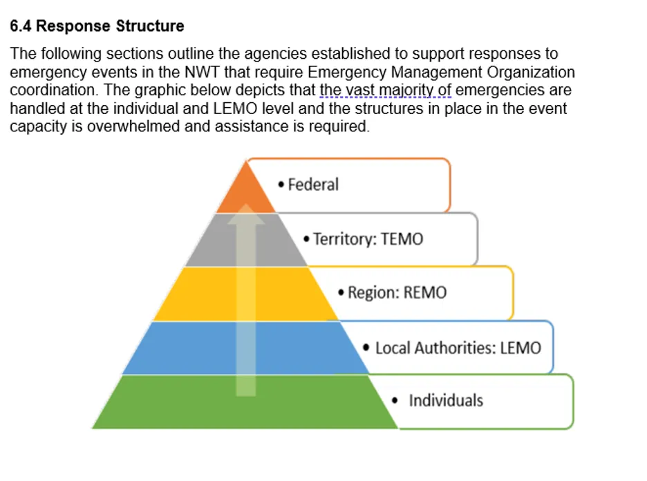
This document highlights the pathways of responsibility for emergency planning, preparedness, and response from the individual to the territorial level. Federal support can be requested if needs go beyond the Territory’s capacity during an emergency. This is not a comprehensive list and has been summarized for the purpose of discussion.
Emergency Planning
Individuals:
Carry primary responsibility for personal emergency planning.
Maintain insurance, identify evacuation destinations, and prepare emergency kits.
Local Authorities:
First level of support during emergencies.
Maintain a Local Emergency Management Organization (LEMO).
Develop and annually update Community Emergency Plans.
Barnes, Justin, Tessa Varvares and Jennifer Spence. “Community Voices on Permafrost Thaw: Workshop Report.” Belfer Center for Science and International Affairs, November 18, 2026
Community Voices on Permafrost Thaw: Workshop Report
De Costa, Ravi. 2014. “Descent, Culture, and Self-Determination: States and the Definition of Indigenous Peoples.” Aboriginal Policy Studies (Edmonton, Alberta, Canada) 3 (3). https://doi.org/10.5663/aps.v3i3.22227.
United Nations General Assembly, United Nations Declaration on the Rights of Indigenous Peoples, G.A. Res. 61/295, U.N. Doc. A/RES/61/295, September 13, 2007.
Patel SS, Rogers MB, Amlôt R, Rubin GJ. What Do We Mean by 'Community Resilience'? A Systematic Literature Review of How It Is Defined in the Literature. PLoS Curr. 2017 Feb 1;9: ecurrents.dis.db775aff25efc5ac4f0660ad9c9f7db2.
Philippe Bourbeau, “A Genealogy of Resilience,” International Political Sociology 12, (2018): 19–35.
Relevant initiatives include the GNWT Climate Change Strategic Framework, the NWT Climate Action Plan, infrastructure standards, land-use planning processes, MACA’s community emergency planning and evacuation/hosting guidance, existing MACA training programs, regional emergency coordination structures, agreements with federal partners and agencies, and ongoing GNWT emergency management improvement efforts.
Barnes, Justin, Tessa Varvares and Jennifer Spence. “Community Voices on Permafrost Thaw: Workshop Report.” Belfer Center for Science and International Affairs, November 18, 2026